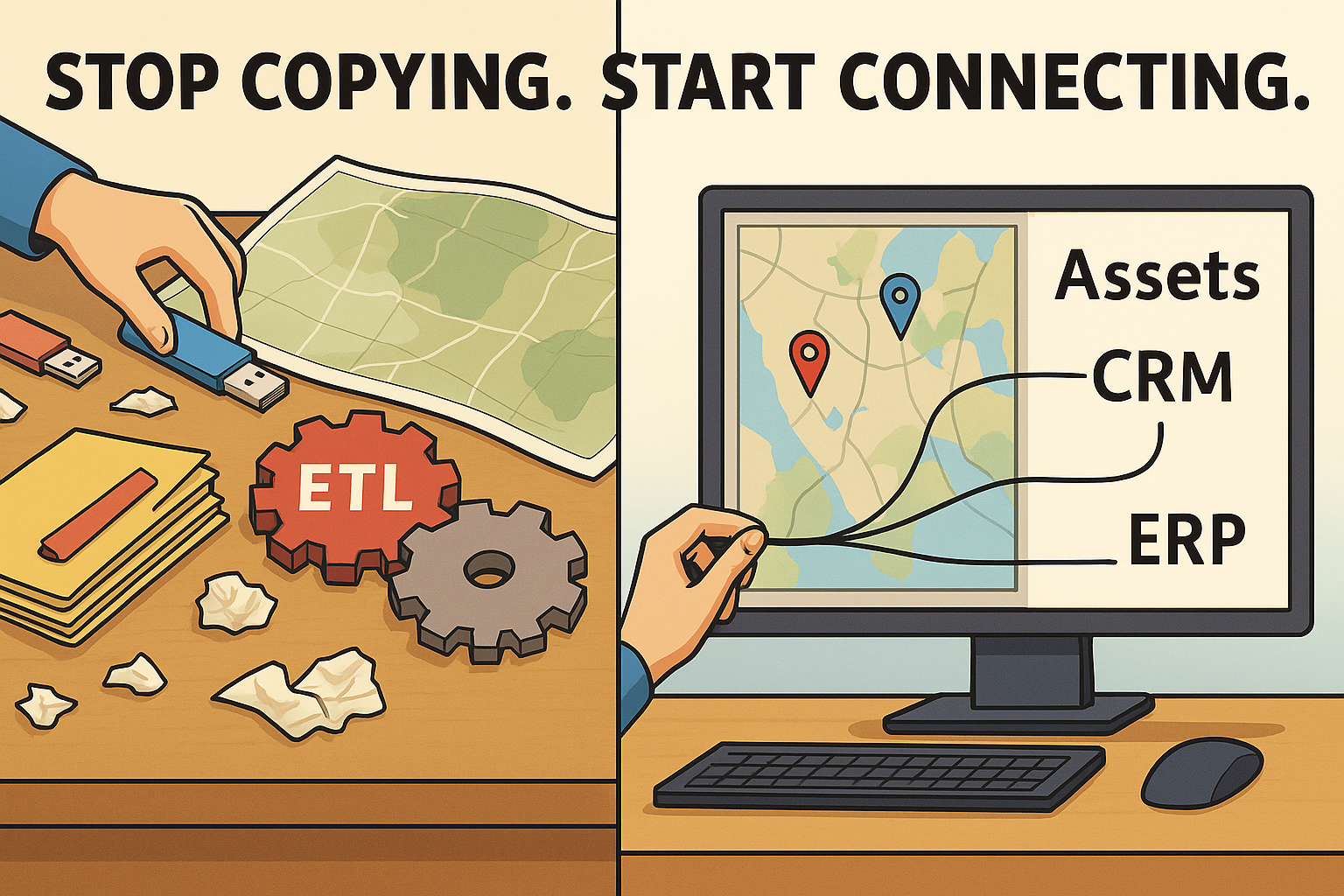
Stop Copying. Start Connecting.
For years, GIS teams have relied on extract-transform-load (ETL) tools to bring data into the map from other systems: asset management platforms, work order systems, customer databases, ERP suites—you name it. The idea is simple: if it’s important to the business, it should be visible in the map.
But there’s a catch. Copying data from other systems into your GIS might seem like integration, but it’s really just replication. And replication comes at a cost that grows as your data, systems, and workflows become more complex.
At Geovonic, we believe it’s time to stop copying and start connecting. Geovonic Connect for ArcGIS changes the game by allowing you to access and interact with data from other systems without ever copying it into the GIS. Just-in-time queries bring fresh data to your maps and apps, and direct integrations support bi-directional workflows. It’s GIS integration reimagined for the modern enterprise.
The Hidden Costs of Copying Data
ETL tools are a staple in enterprise IT. They extract data from one system, transform it into a compatible format, and load it into another system, usually on a scheduled basis. In GIS, ETL is often used to keep spatial and tabular data in sync across systems.
But this approach has serious drawbacks:
1. Data Staleness
No matter how often your ETL jobs run, you’re still dealing with a copy of the truth. That means your GIS may be out of sync with real-time operations, especially in fast-moving domains like maintenance, field service, and customer requests.
2. Duplication and Storage Bloat
Copying data into the GIS leads to data duplication and unnecessary storage costs. You end up managing multiple versions of the same information across different platforms.
3. Fragile Integrations
ETL processes depend on consistent schemas, field mappings, and predictable data formats. A single change in the source system can break the sync, often without anyone noticing until the damage is done.
4. Workflow Silos
Copying data solves the visibility problem, but not the workflow challenge. You can see work orders or assets on the map but you can’t interact with them unless someone builds a custom workflow to push updates back to the source system.
In short, ETL offers GIS users read-only visibility into yesterday’s data. That’s better than nothing but in today’s connected world, it’s not enough.
A Smarter Way: Connect, Don’t Copy
Geovonic Connect for ArcGIS takes a different approach. Instead of syncing data into your GIS, it lets you connect your ArcGIS apps directly to the systems your business runs on like ServiceNow, Salesforce, TechnologyOne, or Civica Authority.
Here’s how it works:
- On-demand data access: When a user opens an ArcGIS app, Geovonic Connect queries the external system in real time and returns the current data. No sync jobs, no stale copies.
- Live feature display: External records are linked to your GIS features (points, lines, polygons) and can be styled and filtered just like native layers. But they aren’t stored in ArcGIS, they’re streamed directly from the source.
- Workflow integration: Users can launch actions in external systems from inside the map. For example, a field inspector viewing a permit area can add notes, reassign tasks, or escalate issues all without leaving the map.
- No custom code: Geovonic Connect is configuration-driven. You don’t need to write custom scripts or maintain brittle integrations. Just define the endpoints, choose the fields to display, and publish the layer.
This architecture offers the best of both worlds: up-to-date data and deep integration with operational systems, without the overhead of data replication.
Integration Is More Than Data Access
Too often, integration is reduced to the question: “Can I see my data in the map?” But that’s only part of the picture.
True integration means aligning people, processes, and platforms so that data, decisions, and actions can flow seamlessly between systems.
Geovonic Connect for ArcGIS supports this broader vision of integration by enabling:
- Actionable maps: Let users do more than view data. With Geovonic Connect, they can trigger workflows, update records, or launch forms in external systems all without leaving the map.
- Context-rich interactions: When a user selects a feature, they can see linked business records like service tickets, customer details, or inspection notes, fetched live from the source system.
- Collaborative operations: Because data isn’t copied into silos, teams stay aligned. Updates in one system are immediately reflected across all connected apps reducing confusion and rework.
Whether you’re tracking jobs, inspecting assets, or managing permits, the ability to connect systems in real time means faster decisions, fewer errors, and better service delivery.
Built for the Modern GIS Landscape
Geovonic Connect is built for ArcGIS Experience Builder and works with both ArcGIS Online and ArcGIS Enterprise. It’s lightweight, cloud-friendly, and designed with IT in mind:
- Secure authentication via OAuth 2.0
- Support for REST APIs and common enterprise platforms
- Scalable architecture with minimal infrastructure overhead
You can start with a simple read-only connection, or go further and enable full two-way workflows. Either way, you retain control over your data, systems, and security posture.
Ready to Rethink GIS Integration?
If your GIS still relies on ETL jobs and data sync scripts to stay connected, it’s time for an upgrade. Geovonic Connect for ArcGIS offers a smarter, faster, and more flexible way to integrate without the complexity of data replication.