
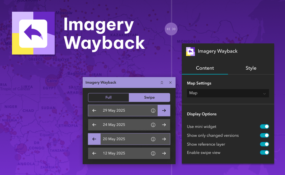
Bring time into your map with the Imagery Wayback widget. This tool connects to Esri’s World Imagery Wayback archive and lets users view past versions of satellite imagery directly in your ArcGIS® Experience Builder apps. With just a few clicks, users can identify when changes occurred at a location and compare different points in time.
Whether you’re monitoring urban development, checking environmental changes, or simply curious about how an area looked before, this widget makes visual time travel easy and interactive. Choose a date, explore updates, and even compare two imagery versions side by side using the built-in slider.
What it helps you do
- View historical versions of Esri’s World Imagery at any location
- Quickly see when satellite imagery changed in your area of interest
- Compare two different imagery dates side by side
- Add visual context to land use, planning, and change analysis
Key features
- Date-aware image selection
Choose from all available imagery snapshots at your current map location - Change detection support
Highlights imagery versions that differ significantly from the current view - Slider-based comparison
Swipe between two selected dates using a simple horizontal slider - Fully interactive and intuitive
Designed for end users with no GIS expertise required
Example use cases
- Investigate land clearing, construction, or redevelopment over time
- Validate claims about when changes occurred at a location
- Support historical research and storytelling with visual evidence
- Present urban growth, deforestation, or disaster impact trends
Using ArcGIS Online?
If you don’t have access to ArcGIS® Experience Builder Developer Edition, try our Hosted Experience Builder environment. It’s the fastest way to start using custom widgets like this one – no local setup or deployment required.